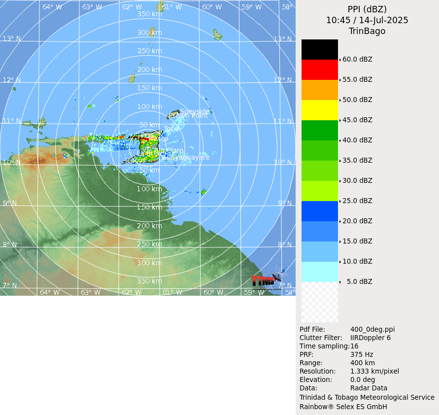
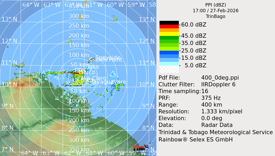
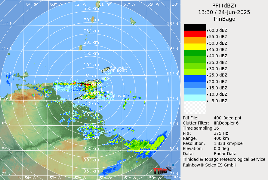
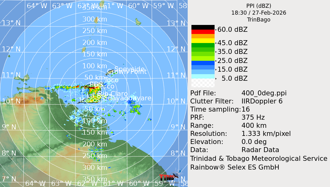
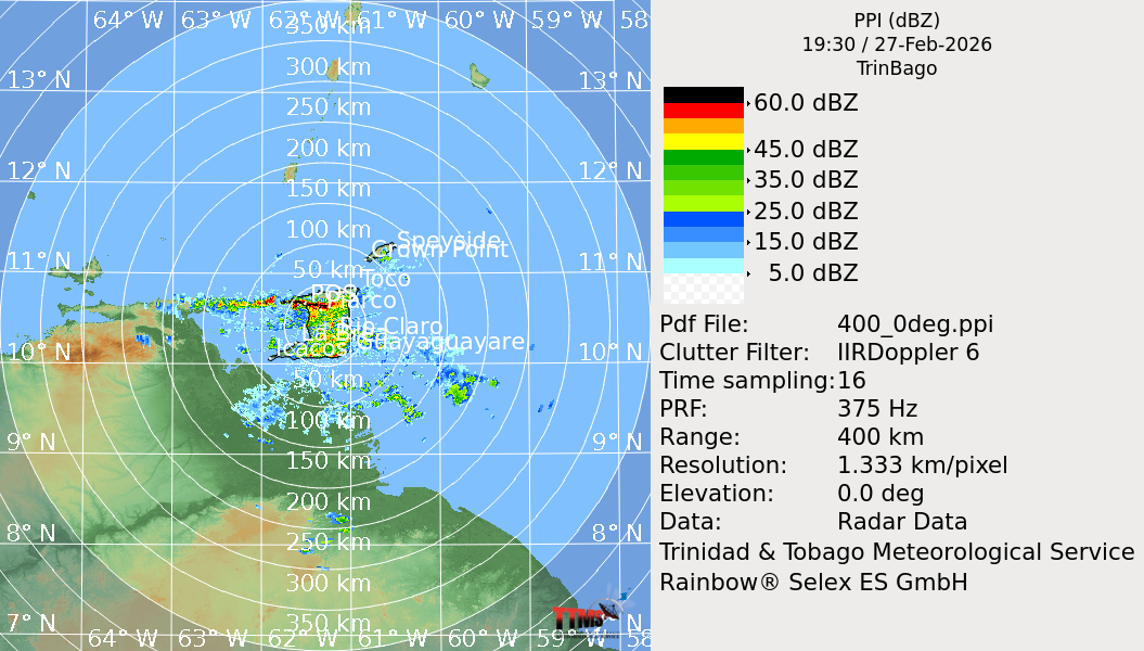
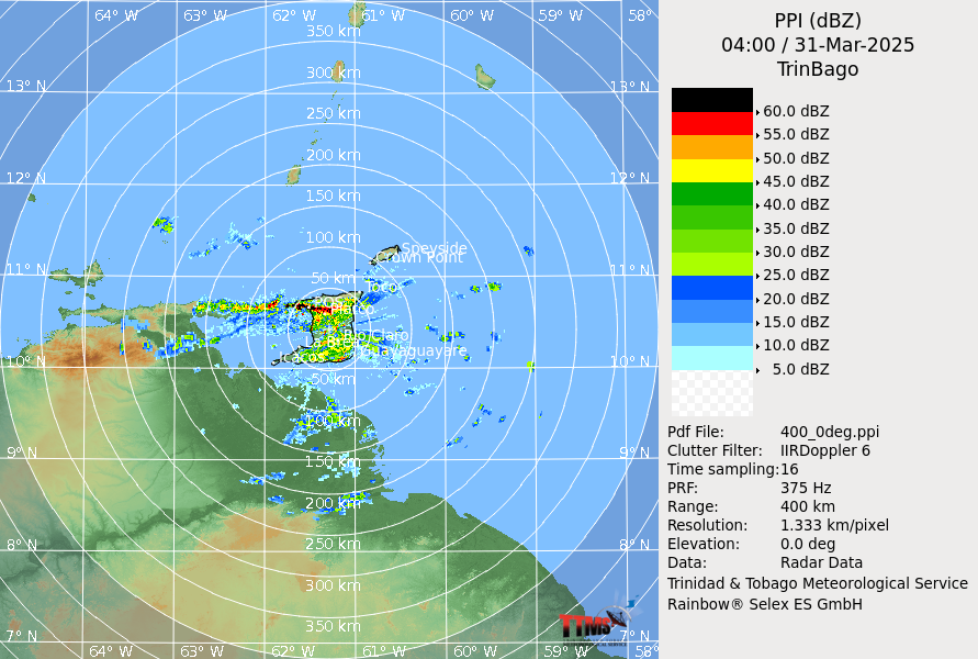
Radar Imagery

Real-time weather radar imagery for Trinidad and Tobago

SRI
Surface Rainfall Intensity

An estimate of rainfall intensity associated with different echoes.

PPI
Plan Position Indicator

A representation of the cloud echoes in a horizontal plane.

MAX
Maximum

Shows a 2 dimensional (2D) flow for the horizontal and vertical profile of the clouds.

EHT
Echo Height Top

Gives a representation of the height to which the top of the clouds extend.

HWIND
Horizontal Wind

Shows wind flow at a specific altitude.

VVP
Velocity Volume Processing

Shows vertical wind profile.